Various types of information technology can benefit forest and ecosystem management. Data obtained with remote and near sensing instruments serve foresters and farmers, scientists and policy makers alike. Remote and near sensing technology as well as data analytics and 3D application find their implementation in research as well as in industry. To the right applications implemented or facilitated by the IT4Forest team are listed to illustrate the potential of IT for forests.

Applications
Practical experience from implementation
- List of Applications
- Regional Forest Cover Change DetectionThe application of remote sensing methods for the detection of forest cover change at regional scale involves the use of multi-temporal datasets or imagery to discriminate areas of forest cover change between dates of imaging or surveying. Images obtained from Earth Observation (EO) platforms are critical in providing a systematic and temporally resolved assessment of spatial changes and the temporal dynamics of forest biophysical parameters. Performing forest cover change detection at regional scale is an important tool mapping loss and gain over tome and to understand important ecosystem processes and drivers of change. Ultimately, spatial or structural changes in the forest cover alters the supply of ecosystem services and can affect the human well-being. Thus the it4forest team uses cloud computing and applies state of the art classifier enhanced by machine learning and AI.
- Monitoring vegetationMonitoring of vegetation includes the compositional, structural and functional attributes of vegetation relative to undisturbed vegetation. Therefore various spatial and structural methods and applications are involved ranging from conventional site-based forest inventories with stratified samples supported by mobile geospatial technology up to innovative mobile laser scanning and 3D point cloud analytics. Monitoring the vegetation status and its biophysical parameters remains a prerequisite for monitoring biosphere reserves and national parks and thus environmental decision-making on a management level. The multidisciplinary it4forest team explicitly integrates different approaches for mapping and monitoring vegetation condition across methods and scales.
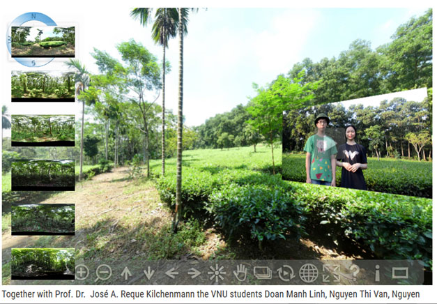
- Forest Virtual ToursVirtual Forest tours (VFT) present an immersive and interactive digital twin of a real forest site. They are created by state-of-the-art virtual reality (VR) technology contributing mainly to a progression and integration of academic E-learning, utilization for environmental education and forest management. Combining 3D geographical reference of image metadata in combination with panoramic portrayals of a geolocation, users can immerse into VFT in a comprehensive way using a digital portal from the real world into a virtual environment. The it4forest team invites you to freely navigate through linked panoramas and diving into virtual forest twin full of realistically rendered trees.
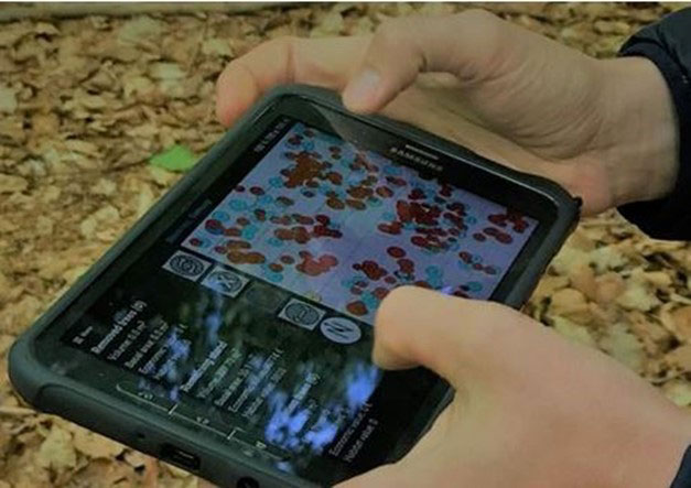
- Augmented RealitiesInnovative and disruptive technological innovations trigger educational advances. Novel sensor-based distance and height measurement tools or wearable augmented realty (AR) devices and cameras have recently been introduced into several University curricula focusing on the environmental sector. Nowadays consumer gadgets and mobile GIS support students during self-organized fieldwork by displaying collected data in a immersive AR. The it4forest team tests and implements new didactical approaches for teaching empirical data collection for forest inventories using AR tools and mobile data collection methods.
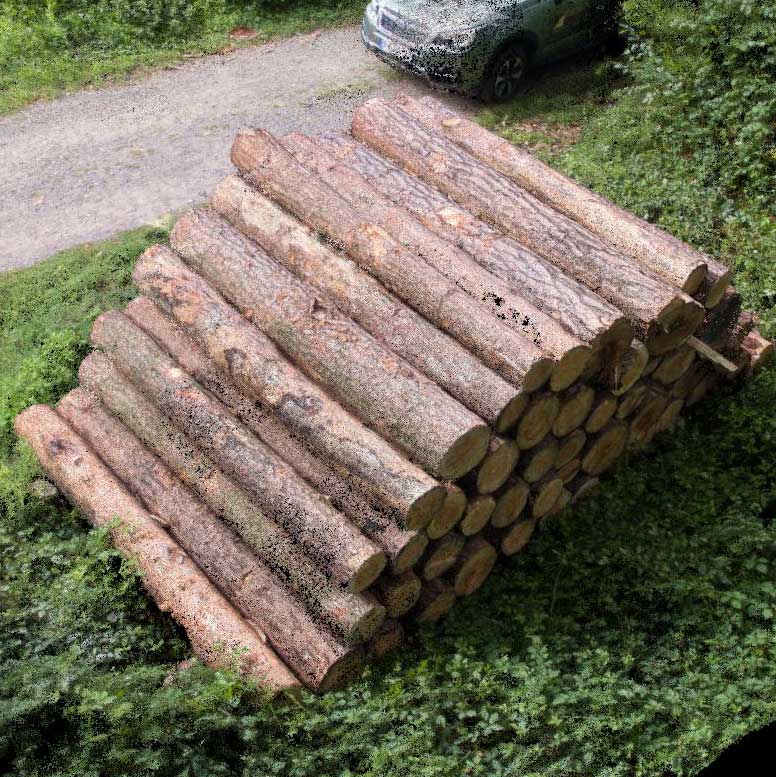
- Biomass quantificationMonitoring, assessing and quantifying biomass are important methods for quantifying spatially terrestrial carbon sinks as well as potential emissions to the atmosphere from land-use change. Spatially explicit or pixel-level Above-ground Forest Biomass (AFB) information is increasingly needed for estimating forest carbon stocks at regional scales. Stand level biomass is frequently calculated from linear and nonlinear regression models established only for specific species based on field measurements. Thus quantification of biomass potential is a useful task that may deem necessary under various ecological or political circumstances. The it4forest team applies most recent methods quantizing forest carbon stocks based on explicit pixel level and regional scale.
- Remote sensing for forest inventoriesWith recent advances in Unmanned Aerial Vehicle (UAV) remote sensing technologies, the possibility to acquire semi-automatically accurate tree heights, crown diameters and stem positions has become a reality. UAV platforms provide a unique opportunity for acquiring low-cost imagery at fine spatial and temporal resolutions from local to regional scales. The it4forest team has proven that ortho-photogrammetric measurements of forest inventory parameters can attain similar accuracies to that of indirect field measurements in an even-aged Scots Pine stand. Furthermore, the it4forest team uses machine learning for tree counting and tree detection from UAV collected data in managed forest stands.
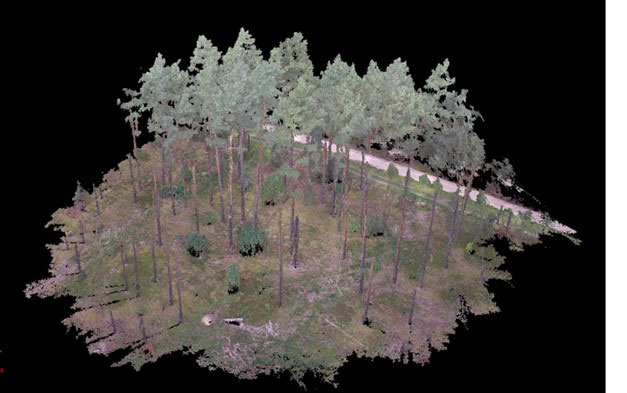
- 3D point cloud data segmentation in forestryTimely and accurate measurements of forest parameters are critical for ecosystem studies, sustainable forest resources management, monitoring and planning. LiDAR or ortho-photogrammetric point clouds have been largely in order to characterize the 3-dimensional (3D) structure of forests. Recently, new object segmenting methods have been proposed utilizing 3D point clouds to construct models describing any 3D woody structure of individual trees. The it4forest team is testing and evaluating different segmentation algorithm combined with a canopy height model to extract individual tree and to derive individual tree structural attributes such as tree height, crown diameter, canopy-based height and other forest inventory parameters
Soil properties in space and time
The great variability of soil properties in their small-scale distribution requires an adjusted site-specific management to avoid wasting resources, environmental pollution and decreasing soil fertility. Proximal soil sensing is a great opportunity to generate highly resolved soil information at field scale in order to depict the within-field variability.
 Geo-electric sensors were the first to be used for vehicle-based soil mapping and have found widespread use in agriculture. However, electrical conductivity is influenced by many soil properties. Therefore, conductivity maps can only be interpreted with additional soil reference sampling. Optical sensors that base on the absorption of light through vibrational excitation of groups of molecules like visible-NIR are also used in this area. To calibrate visible-NIR spectra, extensive reference measurements and signature databases are necessary. Close correlations were found with soil fertility parameters such as organic matter and nitrogen. As a radiometric sensor gamma spectrometry has been used increasingly for soil mapping. Based on the direct measurement of potassium, a connection with plant-available and clay-associated potassium was often found.
On-the-go sensors are tested in field campaigns to investigate the spatial distribution of soil properties. With the help of reference sampling, various sensor outputs are compared with soil analysis results using suitable statistical and geo-statistical approaches. The interpreted, spatially highly resolved sensor signal allows to drive dynamic agro-ecosystem models simulating the spatio-temporal dynamic of soil state variables and to actualize simulated states, such as water and nutrient availability in the respective crop growing phase (DOI: 10.1007/s11119-018-9617-y).